The evolution of drone technology has revolutionized the way we capture images, monitor events, and even deliver goods. However, with the increase in aerial traffic, there’s a vital need to regulate the skies to ensure safety for all. No-Fly Zones for Drones are a critical part of these measures, dictating where unmanned aircraft can operate to prevent conflicts within restricted airspace. The Federal Aviation Administration (FAA) has established clear guidelines regarding drone flight restrictions, which include significant areas known as aerial exclusion zones. Comprehending these restrictions is essential for drone enthusiasts and professionals alike to navigate the skies responsibly.
Whether you’re a hobbyist or a commercial drone operator, understanding these no-fly directives plays a pivotal role in safely integrating drones into the national airspace. Failure to comply not only poses risks to public security and privacy but can attract severe penalties. Adhering to no-fly zones not only epitomizes responsible drone operation but also preserves the integrity of our airspace.
Defining No-Fly Zones in the Context of Unmanned Aircraft
As the airspace becomes increasingly populated with unmanned aircraft, the establishment of prohibited drone zones is crucial to maintaining safety and security. The Federal Aviation Administration (FAA) has taken definitive steps to outline specific areas where drones are not allowed to operate, thus creating a structured environment for both recreational and commercial drone use. These drone no-fly areas are designed to prevent incidents that could compromise air travel, personal privacy, and national security.
FAA’s Definition of a “No Drone Zone”
The FAA clearly delineates “No Drone Zones” to assist both the drone-flying public and enforcement agencies in identifying regions where the deployment of drones is not permitted. This initiative not only promotes awareness but also ensures that unmanned aerial activities remain within the bounds of legal and safety standards. By defining these zones, the FAA seeks to mitigate risks associated with drone flights in sensitive and strategic locations.
Types of No-Fly Zones for Drones
Drone exclusion zones can be primarily categorized based on duration and the nature of the restrictions; whether they are permanent fixtures in the national airspace or temporary measures to safeguard specific events and locations. Recognizing these distinctions is vital for drone operators to navigate the skies lawfully and safely.
| Category | Description | Examples |
|---|---|---|
| Permanent No-Fly Zones | Areas that consistently prohibit unmanned aircraft operations | Airports, Military Bases |
| Temporary Flight Restrictions | Zones established temporarily to protect special events or national security interests | Major Sporting Events, Presidential Movements |
| Local Ordinances | Restrictions imposed by local, territorial, or tribal governments due to specific community concerns | Parks, Residential Areas |
Understanding the types of no-fly zones is a fundamental aspect of responsible drone operation. This knowledge helps operators to ensure they are not infringing upon unmanned aircraft prohibited areas, thereby contributing to the overall safety of the nation’s airspace.
The Legal Framework Governing Drone Flights
The skies above the United States are threaded with an intricate tapestry of FAA regulations, crafted to ensure that both manned and unmanned aircraft coexist safely. The task of complying with drone flight restrictions and obtaining necessary airspace authorization can be complex for drone operators. This is due to the multi-layered nature of the legal framework governing the national airspace system.
To legally navigate the sky, drone pilots must be diligent in understanding the scope of rules that exist at federal, state, and local levels. At the federal level, FAA regulations form the bedrock of drone flight governance. With the proliferation of drones, these regulations are continuously evolving, aiming to integrate drone technology while maintaining the safety and security of the airspace.
“The safe integration of drones is essential to maintaining the integrity of our airspace, and we are steadfast in our commitment to establishing clear rules for operators.”
– Federal Aviation Administration
Adherence to Temporary Flight Restrictions (TFRs) is another critical part of this framework. TFRs are not to be taken lightly, as they signify the necessity to forego flights for the sake of national security or due to the potential risks to public safety during certain events or in the vicinity of specific locations.
In the table below, we present a concise overview of the layers of authorization and the types of airspace where drone flight may be subject to restrictions.
| Airspace Type | Authorization Required | Common Restrictions |
|---|---|---|
| Class B | Yes – Prior Approval | Densely populated areas and major airports |
| Class C | Yes – Prior Approval | Areas around busy airports |
| Class D | Yes – Prior Approval | Areas with operational control tower |
| Class E | Varies – Check for Specifics | Controlled airspace not classified as A-D |
| Class G | No – Open for Use | Uncontrolled, typically safe for drones |
| Special Use Airspace | Yes – Check for Access | Varies based on purpose and time |
| Temporary Flight Restrictions (TFRs) | Yes – Special Authorization | Security or safety-related events |
Drones are not merely recreational or business tools; they represent the emergence of a new aviation paradigm. In this light, the importance of rigorous adherence to airspace authorization protocols cannot be stressed enough. It is both a matter of legal compliance and a testament to the pilot’s commitment to the broader community of airspace users.
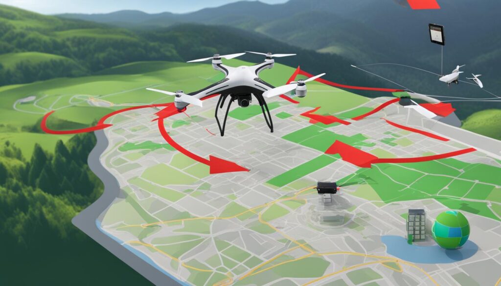
Drone operators must be prepared to engage with this multilayered framework and stay ahead of any changes to ensure that their flights are not just fulfilling their intended purpose, but are also emblematic of safe and responsible airspace usage.
Exploring Restricted Airspace for Drone Pilots
As the skies grow increasingly crowded with unmanned aerial systems, understanding the underlying rules that govern aerial travel becomes more crucial for drone pilots. The Federal Aviation Administration (FAA) plays a key role in defining and implementing controlled airspace to ensure safety and security in the national airspace system. Entering restricted flight zones without permission can result in significant consequences, highlighting the importance for drone operators to stay informed about these regulations.
Permanent No-Fly Zones Over Critical Infrastructure
Areas designated as permanent no-fly zones are typically identified to protect sensitive infrastructures, such as power plants, military facilities, and government buildings. These restricted flight zones are clearly marked as off-limits to drone pilots to guard against any threats to national security or potential accidents. Flying a drone in these areas without proper clearance can lead to enforcement actions which emphasize the importance of respecting these restricted zones.
Drone Restrictions in Controlled Airspace
The categorization of controlled airspace by the FAA is an intricate system aimed at segregating aircraft types and establishing order among varying flight operations. Drone pilots must be especially diligent in these areas, understanding the distinctions between the classes of airspace and the associated rules. To assist in complying with these rules, let’s examine the characteristics that define controlled airspace.
| Class of Airspace | Requirements for Drone Pilots | Availability for Drone Flight |
|---|---|---|
| Class B | Communicate with ATC, hold appropriate certifications | Authorization required before flights |
| Class C | Certification, Equipage and Communication | Must have prior authorization |
| Class D | Pilot certification needed, two-way communication | Subject to operational requirements |
| Class E | Depends on altitude; marked on aeronautical charts | Generally, no specific authorization needed |
| Class G | None; uncontrolled airspace | Open for drone flights under FAA rules |
Failure to comply with the restrictions inherent to controlled airspace can lead to breaches of restricted airspace regulations. Adherence to these guidelines not only keeps the airspace safe but also ensures that drone pilots can avoid the legal implications that arise from unauthorized incursions into restricted zones.
Note: The above airspace classification is applicable within the United States and may vary in other countries.
No-Fly Zones for Drones Based on Location
Under the vigilant eye of regulatory bodies, unmanned aerial vehicles (UAVs) or drones face stringent flight protocols to ensure safety and privacy in varied locations. The invisible boundaries in the sky, identifiable as local drone flight restrictions, prohibited drone zones, and aerial exclusion zones, serve as non-negotiable barriers that dictate the flight paths of these high-tech devices.
Local Government-Imposed Restrictions on Drone Operations
In pursuit of maintaining order and security within their communities, local governments hold the power to implement specific drone flight restrictions. These measures are often focused around sensitive areas where the activities of drones could cause disruptions or invade privacy. By navigating these restrictions with skill and precision, drone operators can fly responsively within the guidelines set forth by municipal authorities.
Prohibited Drone Zones Around National Landmarks and Public Events
As one might anticipate, national landmarks and large-scale public events fall under the category of prohibited drone zones. This is due to their heightened need for security and the potential for a drone’s presence to be misinterpreted or even to pose a threat. Operators are expected to steer clear of these areas, thereby contributing to the collective effort to uphold national safety standards and privacy expectations.
The vigilance in enforcing these aerial exclusion zones cannot be overstated. It is incumbent upon those piloting drones to remain up-to-date with all regulations that may affect their planned flight paths. The onus is on them to be well-informed and cautious, as inadvertent airspace infractions can carry severe consequences.
Temporary Flight Restrictions (TFRs) and Drones
While the integration of drones into the national airspace brings numerous opportunities, it also calls for stringent management of flight activities, especially during events where safety and security are of the utmost priority. Temporary Flight Restrictions (TFRs) serve as a regulatory tool to ensure that significant national events can proceed without the threat of unauthorized aerial interference.
TFRs During Significant National Events
Implemented as a necessary response to immediate or planned occurrences of a sensitive nature, TFRs establish drone exclusion zones to safeguard venues and attendees. These restrictions, often announced in conjunction with major events such as political conventions, disaster response operations, or large-scale public gatherings, prohibit drone pilots from flying their unmanned aircraft without prior clearance.
TFRs and How They Affect Recreational and Commercial Drone Use
Recreational and commercial drone pilots alike are impacted by TFRs, with each group necessitating proactive operations planning to comply with temporary no-fly regulations. It is essential for drone operators to be aware of these restrictions and understand how to seek authorization if flights within a TFR are integral to their purpose, whether for recreation or business.
| Aspect | Recreational Drone Use | Commercial Drone Use |
|---|---|---|
| Authorization | Seek waivers through FAA’s DroneZone | Coordinate with FAA for possible exemptions |
| Compliance Monitoring | Check for NOTAMs and adhere to B4UFLY app guidance | Utilize LAANC and monitor TFR listings for updates |
| Operational Impact | Limited ability to fly in TFR zones without clearance | May require adjustments to flight plans and scheduling |
| Penalties for Violation | Potential fines and revocation of flying privileges | Heftier fines, legal consequences, and impacts on licensure |
The dynamic nature of TFRs demands that all drone pilots engage in consistent monitoring of airspace changes from trusted sources such as the FAA. These timely updates allow pilots to adjust their activities accordingly, avoiding the legal consequences of non-compliance and contributing to national safety. Being well-informed of Temporary Flight Restrictions and acknowledging the scope of drone exclusion zones are now integral parts of responsible drone ownership and operation.
How Drone Technology Respects No-Fly Boundaries
As drone technology continues to evolve, it has become increasingly important to ensure that these unmanned systems operate within safe and legal parameters. One of the key ways drone manufacturers and regulators maintain this balance is through innovative geo-spatial solutions such as geofencing.
Geofencing: Automated Compliance with No-Fly Zones
Geofencing stands as a cornerstone in maintaining the integrity of no-fly zone enforcement. By creating virtual boundaries, geofencing technology automatically restricts a drone’s movements, preventing it from breaching sensitive areas. This automated compliance mechanism is crucial for ensuring that both recreational and commercial drone operators respect no-fly zones, including areas near airports, government buildings, and military installations.
Technological Solutions for No-Fly Zone Enforcement on Drones
In the sphere of aerial innovation, drone technology must prioritize safety and privacy without stifling the growth and capabilities of these versatile machines. Technological enforcement solutions ensure that drones do not compromise secure spaces, providing a layer of protection that is both dynamic and non-intrusive.
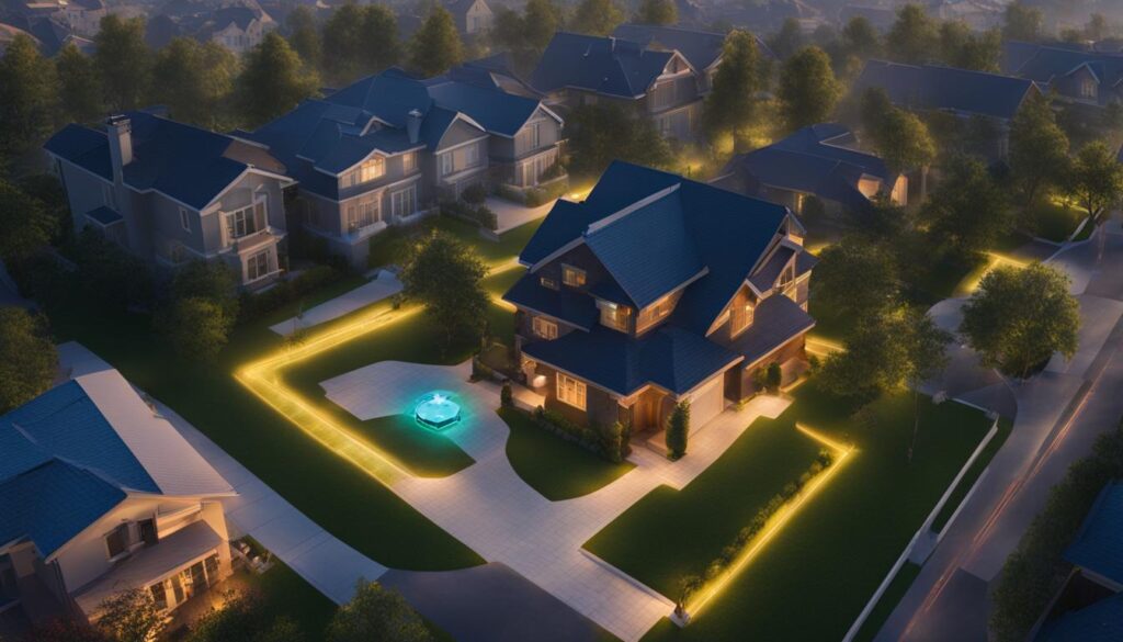
Below is a comparative analysis of the capabilities provided by current geofencing solutions in popular drones:
| Feature | Capability | Benefits |
|---|---|---|
| Automatic Updates | Real-time updates of no-fly zones | Ensures drones operate within current legal constraints |
| User Alerts | Notifications sent to operator’s device | Increases pilot awareness and prevents accidental incursions |
| GPS Precision | High accuracy for boundary detection | Minimizes the risk of airspace violations |
| Custom Geofencing | Ability for operators to define their own no-fly zones | Enhances safety in sensitive or private locations |
Through the implementation of geofencing and other digital enforcement tools, the drone industry continues to demonstrate a commitment to responsible flight practices, ensuring that the skies remain safe for everyone.
Consequences of Violating Drone No-Fly Zones
To ensure the integrity of national security, public safety, and individual privacy, the U.S. government enforces significant penalties on unauthorized drone flights. The implications are serious; disobeying these regulations can result in hefty fines and even criminal charges. To underscore the gravity of these restrictions, an understanding of the severity and range of potential legal repercussions for drone pilots is essential.
Drone operators must be vigilant, ensuring they do not breach restricted areas. Ignorance of the law is no excuse and will not spare operators from the consequences. Below we outline various punitive measures that operators could face if found operating a drone within no-fly zones.
- Monetary Fines: Imposed for minor first-time infractions or for more severe repeat offenses.
- Criminal Prosecution: Possible for egregious violations that threaten air-traffic safety or national security.
- Civil Penalties: May include additional fines or other sanctions such as the suspension of a drone license.
- Asset Forfeiture: In some cases, unauthorized drones may be confiscated by authorities.
- Damages and Restitution: For any harm caused by unauthorized flights, drone operators may be held liable.
Operating a drone in violation of FAA regulations is a serious offense and will be met with the full force of the law. – FAA Statement
The FAA and law enforcement agencies encourage drone operators to observe all airspace restrictions. Avoiding unauthorized drone flights is crucial for the broader acceptance and success of drones in commercial and recreational usage. Compliance is not just legally mandated—it is a cornerstone of responsible drone usage and is pivotal in fostering a culture of safety and respect within the unmanned aviation community.
Pre-flight Planning Tools for Drone Pilots
As aviation technology evolves, the need for precise and responsible drone flight planning becomes paramount. The Federal Aviation Administration (FAA) highlights the significance of using dedicated pre-flight planning tools to ensure safety and compliance in the airspace. These tools equip drone operators with the essential information on airspace restrictions and authorization requirements.
Overview of B4UFLY Mobile App for Identifying Drone No-Fly Areas
The B4UFLY mobile app functions as an essential resource for recreational drone flyers to identify no-fly zones quickly and easily. Developed by the FAA, this app provides users with real-time maps and information, ensuring that drone pilots are well-informed about the areas where they intend to fly. The use of the B4UFLY app is not only recommended for safety but is also mandated as part of responsible drone pre-flight planning.
LAANC: Streamlined Access to Controlled Airspace Authorization
For access to controlled airspace, the FAA has innovated the Low Altitude Authorization and Notification Capability (LAANC). This system facilitates rapid airspace authorizations, allowing both hobbyist flyers and Part 107 drone pilots to receive instant permission to operate in regulated airspaces. LAANC is a breakthrough in drone pre-flight planning, providing a digital interface that replaces lengthy traditional authorization processes.
To complement your understanding of these pivotal tools, below is a comparison table that outlines their respective features and target users:
| Feature | B4UFLY Mobile App | LAANC |
|---|---|---|
| User Target | Recreational Flyers | Recreational Flyers and Part 107 Pilots |
| Function | Identifies no-fly zones | Provides airspace authorizations |
| Advantage | Enhanced situational awareness | Real-time authorization |
| Accessibility | Mobile Application | Mobile and Web-based platforms |
| Operation Guidance | Direct information on airspace restrictions | Streamlined process for airspace access |
Utilizing the B4UFLY app and LAANC together forms a comprehensive approach to drone pre-flight planning. They serve as the backbone of a pilot’s preparation, ensuring that each flight is conducted within the bounds of legality and safety. It is imperative that drone operators integrate these tools into their standard flight routines to mitigate risks and contribute to safe skies for all.
International Perspectives on Aerial Exclusion Zones
When it comes to managing international no-fly zones, regulatory landscapes across the globe present a complex patchwork of rules and restrictions impacting drone operations compliance. As the scope and variety of drone applications expand, from commercial delivery services to environmental monitoring, adhering to global drone regulations remains a paramount concern for operators aiming to navigate international skies responsibly.
Differences in No-Fly Zone Regulations Around the World
Each nation adopts its own set of regulations to oversee the use of drones within its airspace, thus necessitating a thorough understanding of regional protocols. Countries like the United States and the United Kingdom have implemented comprehensive systems for monitoring and controlling drone traffic, particularly near airports and sensitive areas. Conversely, other regions may impose more relaxed restrictions, or their enforcement might not be as rigorous.
Impact on International Drone Operations and Compliance
The lack of standardization in international regulations poses significant challenges for drone operators who engage in cross-border projects. Despite these challenges, drone pilots are required to stay abreast of local laws to ensure seamless and legal operation of their unmanned aerial vehicles (UAVs). The table below highlights the variance in no-fly zone rules in selected countries, shedding light on the complexities of international drone flight compliance.
| Country | No-Fly Zone Regulations | Compliance Mechanisms | Enforcement Rigor |
|---|---|---|---|
| United States | Highly restricted around airports, military bases, and national parks | LAANC, B4UFLY App, and Geofencing | Strict enforcement with potential for heavy fines and legal penalties |
| United Kingdom | Restricted near airports, prisons, and designated royal parks | DroneSafe App and mandatory registration | Considerable enforcement with emphasis on safety and privacy |
| Canada | Avoidance of airports and emergency operation areas without permission | Canadian Aviation Regulations and mandatory safety training | Enforced through regulations and awareness programs |
| Japan | Restrictions near airports, over crowded areas, and at night without authorization | Registration and pilot certification required | Moderate enforcement with focus on education and compliance support |
| Brazil | Banned over critical infrastructure and near airports without clearance | Registration with ANAC and adherence to VANT regulations | Active enforcement with penalties for non-compliance |
Emerging patterns suggest an ongoing international effort to harmonize drone regulations to support the growth of UAV activities while addressing safety, security, and privacy concerns. Stakeholders, including regulatory bodies, industry experts, and drone operators, are increasingly advocating for standard protocols that could pave the way for more predictable and streamlined drone operations compliance on a global scale.
Understanding Airspace Classification Impact on Drone Operations
The intricate tapestry of airspace regulation affects every unmanned aerial vehicle (UAV) in flight. Navigating this complex airspace infrastructure is critical for drone pilots to conduct safe and effective operations. Whether managing a drone for recreational or commercial purposes, understanding the difference between controlled and uncontrolled airspace, as well as the implications of Special Use Airspace, is fundamental.
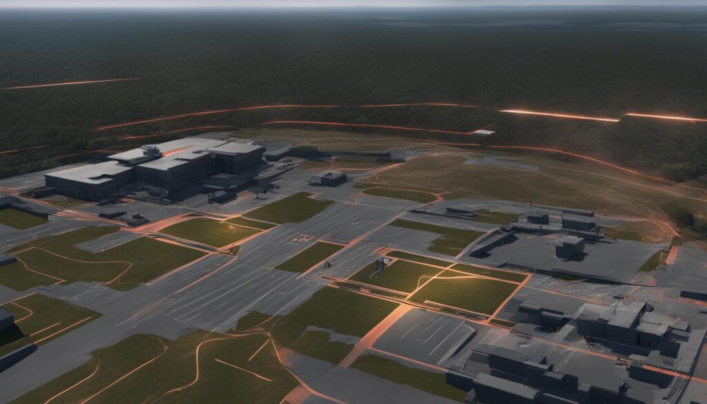
Controlled vs. Uncontrolled Airspace for Drone Routes
Controlled airspace is defined as an area where air traffic control services are provided. These regions are designed to facilitate safe flight operations by providing support through air traffic control communication. This means drone operators must be aware of certain requirements such as remote pilot certification and, where applicable, obtaining prior authorization to fly in such airspace. Meanwhile, uncontrolled airspace does not provide active air traffic control services, allowing for more freedom in operation but with an assured level of safety awareness and responsibility from the pilot.
Special Use Airspace and Unmanned Aircraft Prohibited Areas
Special Use Airspace encompasses areas where activities that are hazardous to non-participating aircraft may occur. These spaces often require additional navigation considerations and restrictions for drone pilots to avoid interfering with these operations.
| Type of Special Use Airspace | Description | Impact on Drone Operations |
|---|---|---|
| Prohibited Areas | Areas where flying is strictly forbidden due to security concerns or other hazardous conditions. | Drones are not allowed to enter these regions at any time. |
| Restricted Areas | Areas where operations are hazardous to non-participating aircraft and could pose risks. | Drones may require special authorization to fly or may be subjected to time-based restrictions. |
| Warning Areas | Extends from three nautical miles outward from the coast of the United States to contain activity that may be hazardous. | Drone pilots are warned to proceed with caution or to avoid these areas completely depending upon current circumstances. |
| Military Operation Areas (MOAs) | A designated area where military training activities are conducted. | While not wholly restricted, awareness and potential avoidance during active times are advised to UAV operators. |
Adherence to these airspace classifications is imperative for maintaining controlled and uncontrolled airspace integrity, ensuring safety for all aerial traffic. As the skies become increasingly populated with drones, familiarization with air traffic control services and operational mandates within Special Use Airspace will continue to be essential for responsible drone usage.
Conclusion
The interplay of technological advancements and regulatory frameworks has reshaped the landscape of drone operations, underscoring the imperative for heightened airspace safety awareness. The delimitation of no-fly zones is more than a mere administrative imposition; it is a cornerstone of safe drone operation, ensuring that the proliferation of unmanned aircraft systems enriches rather than encroaches upon the communal airspace. As the capabilities of these systems evolve, so does the spectrum of responsibilities shouldered by drone pilots to maintain operational harmony.
In this dynamic arena, staying informed about the locations and dimensions of no-fly zones is not optional but obligatory for unmanned aircraft system compliance. The willingness to engage with tools provided by regulatory bodies, an unflagging commitment to the legal stipulations governing aerial ventures, and the practice of conscientious piloting are the hallmarks of progressive drone usage. Each lift-off mandated by regulation is not merely an act of adherence but a testament to the pilot’s dedication to collective aerial safety.
The future of drone flight is indelibly linked to the seamless integration of regulations that emphasize safety, privacy, and security. Hence, operators must not only keep abreast with current guidelines but also contribute to a precedent of responsibility that will define the tenor of unmanned flight for generations. The essence of responsible drone operations lies not just in enjoying the vistas from above, but in safeguarding the integrity of the skies for all.
FAQ
What are No-Fly Zones for Drones?
No-Fly Zones for Drones, also known as “No Drone Zones,” are defined areas where the operation of drones or unmanned aircraft systems (UAS) is restricted or entirely prohibited for reasons of safety, security, and privacy. These zones are established by the Federal Aviation Administration (FAA) and can vary depending on the specific location and the need for restriction.
How does the FAA define a “No Drone Zone”?
The FAA defines “No Drone Zones” as areas where drone activities are restricted or forbidden. These can include permanent airspace closures, temporary flight restrictions (TFRs), and areas determined by local ordinances. No-fly zones are in place to protect critical infrastructure, such as airports and nuclear plants, national landmarks, and during events where security measures require areas to be clear of unmanned aircraft.
What types of No-Fly Zones exist for drones?
The types of No-Fly Zones for drones include prohibited drone zones, unmanned aircraft prohibited areas, drone no-fly areas, and drone exclusion zones. These can be permanent, temporary, or based on the operational scope and can encompass areas around critical infrastructure, during significant national events, and in sensitive localities designated by local governments.
What legal framework governs drone flights and their restrictions?
Drone flights in the United States are regulated under a framework that includes FAA regulations and restrictions, as well as state and local ordinances. The FAA controls airspace authorization for drones, which encompasses controlled airspace restrictions, Temporary Flight Restrictions (TFRs), and other specific drone flight limitations necessary for safety and compliance.
What are Permanent No-Fly Zones for drones, and where are they located?
Permanent No-Fly Zones are areas where drone flight is forever restricted to protect critical infrastructure and national security interests. These areas include, but not limited to, military bases, nuclear facilities, and certain strategic landmarks that are vital to national interests. Drone flights within these zones are strictly prohibited without specific authorization.
How does controlled airspace affect drone restrictions?
Controlled airspace is divided into different classes that dictate specific requirements for drone pilots, including certification and communication protocols. Drone operators must be aware of these classes and adhere to the associated restrictions when planning their flights to avoid penalties for violating restricted flight zones within controlled airspace.
How are No-Fly Zones for drones determined based on location?
No-Fly Zones based on location are determined by local government-imposed restrictions, particularly focusing on drone takeoff and landing areas. They also include federally designated No-Fly Zones over national landmarks, major sporting events, and significant public gatherings to ensure both safety and privacy.
What are TFRs and how do they affect drone usage?
Temporary Flight Restrictions (TFRs) are short-term airspace restrictions implemented for safety or security reasons, such as during significant national events or for protecting VIP movements. TFRs affect both recreational and commercial drone operators, who must obtain prior authorization to fly in the designated areas during the period the TFR is in effect.
How does geofencing help with compliance to no-fly zones?
Geofencing is a technology used in drones that employs GPS to create virtual boundaries, automatically restricting the drone’s ability to enter no-fly zones. This technological solution aids drone pilots in adhering to no-fly regulations by preventing the drone from flying into unauthorized areas, thereby enhancing overall airspace safety.
What are the consequences of violating drone no-fly zones?
Violation of drone no-fly zones can result in serious legal consequences, including monetary fines and criminal prosecution. These penalties reflect the importance of maintaining national security, public safety, and privacy when operating unmanned aircraft within the national airspace system.
What pre-flight planning tools are available to drone pilots?
Drone pilots can utilize pre-flight planning tools such as the B4UFLY mobile app and the Low Altitude Authorization and Notification Capability (LAANC) system. The B4UFLY app provides recreational flyers with information on airspace restrictions, while LAANC offers both recreational and Part 107 pilots real-time authorizations for flights in controlled airspace.
How do international no-fly zone regulations differ from those in the United States?
International no-fly zone regulations can vary greatly from country to country. Some nations have strict rules like those in the United States, while others may have more lenient approaches. Drone operators must familiarize themselves with and adhere to the regulations of each country in which they operate to ensure compliance and safe drone usage.
What impact does airspace classification have on drone operations?
Airspace classification has a significant impact on drone operations, as it determines the rules and requirements for different areas of the sky. Controlled airspace demands strict adherence to operational guidelines, whereas uncontrolled airspace may have fewer restrictions. Special use airspace, including Restricted and Warning areas, designated as unmanned aircraft prohibited areas, introduce additional considerations that drone pilots must be aware of for safe flight.
Leave a Reply